Although the original idea of our trip to Spain and Portugal was to see Talavera I was most excited about the idea of seeing Wellington’s Lines of Torres Vedras.
When Wellington took command of the British forces in Portugal in 1809 he was very aware that this was Britain’s only field army facing Napoleon’s troops. At the beginning of that year the army, then under the command of Sir John Moore, had been driven to retreat by the French. The retreat to Corunna was a disaster for the British who came close to losing their army. Thanks to victory in the battle of Corunna, Moore was able to evacuate his troops by sea, but it was a close-run thing. Wellington was determined that if he found himself retreating from superior French forces he would have a secure base that he could withdraw on.
Wellington decided that if his forces had to be evacuated, they would be evacuated from the banks of the Tagus. Lisbon, the landing point for British troops, would also be the base to which he could withdraw.
Portugal then (as now) had a small population. Wellington reckoned that the temporary loss of Portuguese territory was not a strategic problem provided that the army was preserved. In fact, he realised that letting the French occupy most of Portugal could provide a significant strategic advantage to the British. Wellington planned a scorched earth policy which would leave the French army, which famously lived off the land, without food or shelter in the Portuguese countryside while the civilian population and the Anglo Portuguese army sheltered safely in Lisbon.
The French could deploy more troops on the Peninsula that the British, so Wellington knew that he was vulnerable if he found himself defending Lisbon in a conventional siege. He therefore planned a series of defensive works that he was confident the French would be unable to breach. These defensive works became known as the Lines of Torres Vedras, named after the town of Torres Vedras which lay at the centre of the lines.
The key to Wellington’s defensive strategy was that Lisbon is built on a peninsula.
The British controlled the sea and hence also the estuary of the Tagus. The French would therefore have to attack from the North.
Wellington’s plan was to build a line of forts on the mountainous countryside around Torres Vedras. The line ran from the Atlantic to the Tagus. Gunboats on the Tagus could deny the French access to the flat land near the river so they were unable to bypass the defensive line.
The line was not a continuous wall, like the Maginot Line. Instead it relied on a series of forts (technically redoubts), which enabled Wellington to lay down heavy artillery fire on the limited number of passes over the mountains. Most of the forts were small and would not have held for long against a determined attack, but each fort was supported by other forts on either side. Behind the lines Wellington built roads which enabled him to move reinforcements rapidly to any area where the French forces posed an immediate threat. Eventually (by 1812) there were 152 redoubts in the lines.
It was a stupendous feat of military engineering and I really wanted to see it.
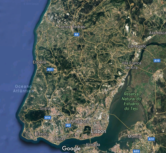
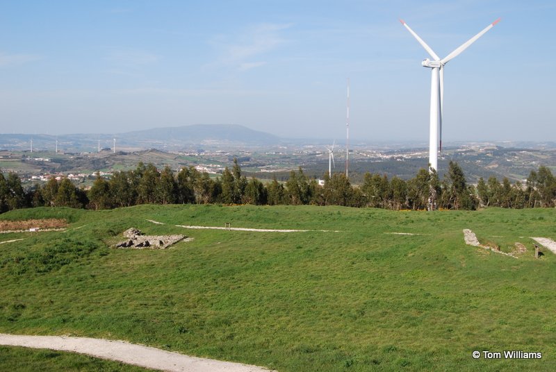
The hills in the distance are part of the natural defences
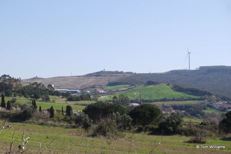
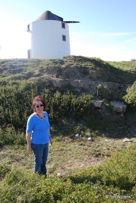
While we had struggled to find Peninsular War sites in Spain, the Portuguese see the lines of Torres Vedras both as a source of national pride and a valuable way of drawing in tourists, so the route was well signposted, though after several miles of steadily steeper and narrower roads my long-suffering wife did wonder if we were lost. No, I assured her, the forts would be at the very top of the hills. And there, indeed, was the first of the redoubts that we found: the Forte Novo or New Fort.
It was one of the smaller forts. Like many of them it was built around a windmill that served as an ammunition bunker for the powder that would supply the five cannon that were placed there. After 200 years it was in impressively good condition. Like all the forts, it was defended by a ditch a two earth ramparts. This was one of the ports where the earth was faced with stone. Although this fort seems not to have had much (if anything) in the way of restoration work, the ditch and the earthworks inside are still impressive.
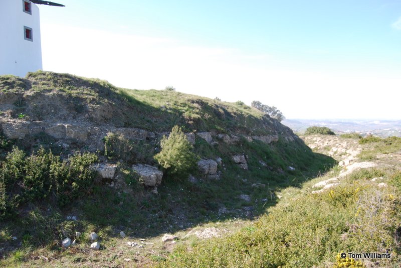
Looking down from the fort, you can see how the natural lie of the land made it an easily defensible position because of the slope that an attacker would have to climb up, while its situation enabled it to control the road below. This was one of the later redoubts. Some of the earlier ones were situated on such steep elevations that their cannon were virtually useless because they could not be depressed enough for them not to overshoot the path at the bottom of the hill.

Forte Novo was one of the smaller redoubts that provided flank protection to one of the biggest redoubts, the Great Redoubt at Sobral. When Wellington was stationed at his headquarters at Pero Negro he would ride to the Great Redoubt every morning as its location gave him an excellent view of any approaching enemy.
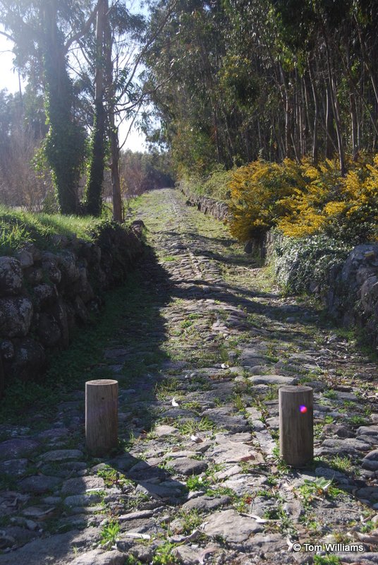
This is the military road that he used.
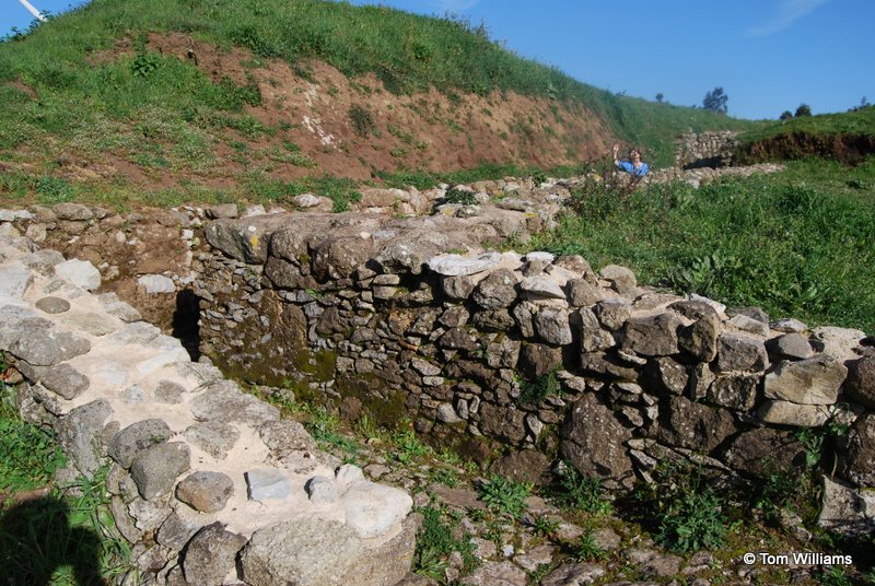
The Great Redoubt was, as its name suggests, large. It had 27 cannon and was garrisoned by 1,590 men. The photo below shows only a section of the fort with the remains of the Governor’s House clearly visible. The works on the right of the picture are an ammunition store as are those you can just see on the left.
The picture was taken from the site of the semaphore mast. The Grand Redoubt was part of the chain of semaphore masts which allowed messages to be sent from one end of the lines to the other, making it an especially useful point from which Wellington could make his plans for facing the French, had the French turned up.
As my son is an Ammunition Technical Officer with the British Army I was particularly interested in the munitions stores. There were several different designs. Not all were underground (I’ve already mentioned that windmills were often converted for this purpose) but the ones at the Grand Redoubt seem to have been. This one had a dog’s leg entrance, protecting against a direct hit passing in through the door.
This has similar precautions at the entrance but the design is otherwise quite different. It takes advantage of the fall in the ground to make something a lot deeper. It’s typical of the way these forts were designed that each one is different, reflecting the topography of the area where it is built.
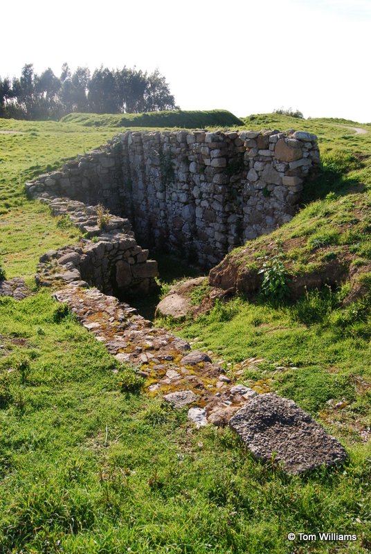
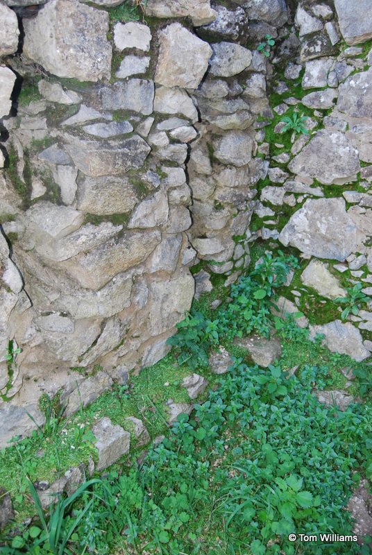
This storage bunker it is particularly interesting because you can see how the stonework allowed for a wooden floor to be fitted so that powder was not damaged by damp rising from the ground.
There were half a dozen smaller forts around the Great Redoubt. We just had time to visit one more: Simplicio Fort. This had just six cannon and a garrison of 300 men. It’s an interesting contrast with the Great Redoubt because while there has been some conservation work at the Great Redoubt (noticeably stabilising the stone facings with concrete), Simplicio Fort seems to have been left pretty much alone, yet it the basic structure is still clear.
The ditch here does not appear to have been stone-faced. The stonework is the remains of another ammunition store.


As you can see from the shadows, we had spent hours exploring the Great Redoubt and the area around it. It was time to brave the mountain roads again and press on. The next day we were going to visit the biggest of the fortifications, Fort San Vicente, just above Torres Vedras which gave the lines their name. That’s a story for next week’s blog.
Thank you
Thanks to Robert Pocock of Campaigns and Culture for planning our trip for us. Campaigns and Culture organises tours of European battle sites and more. Robert is now busy planning future tours to the Peninsula with the possibility of bespoke tours before that if you want to hire his services privately. You can find details of his business at www.campaignsandculture.com.
Robert is a well-regarded expert on the Napoleonic Wars with a wider interest in military history that means he can provide significant insight into battlefields from Ramilies to Dunkirk. If you are interested in a trip like ours and don’t want to take your chances driving on some of the ‘interesting’ roads we found ourselves travelling on, I do recommend that you get in touch with Robert.
Thanks for this great post, Tom, it’s given me a real flavour of what to expect when I visit the Lines later this year. Are the roads there really that ‘interesting’? It sounds like I might need to keep my eyes closed until we reach the top!
The road to the Great Redoubt is fairly narrow and twisting. What makes it particularly alarming is the locals driving at speed down the hill as you nervously make your way up.
A splendid post and the photographs are wonderful. Shared on my Dawlish Chronicles site.
Thank you.
Thoroughly enjoyed this post and jealous of the good weather you had; we saw the lines in pouring rain mostly. Although that’s a good excuse to go back…
A great series of blogs Tom, most enjoyable. They should inspire many more to tour this wonderful region. Looking forward to your next book!
Thank you.